Topographic skills are rare these days. But even if you are an ordinary traveler or an expert wanderlust, spatial intelligence can now be achieved with clear and accurate maps.
Familiarizing with directions is not easy for some people. That is why some people got maps. Ever wonder how adventure seekers and expert-mountain-guide can confidently go up and back down the terrain without getting lost or stuck for days in a massive ecological space?
This article will introduce you to one of the useful topographical devices that you will need to expand your skills. Raised relief maps are unlike typical paper maps. These maps are like a 3D rendering of the Earth!
Now let’s take a closer look!
Getting Started with Raised Relief Maps
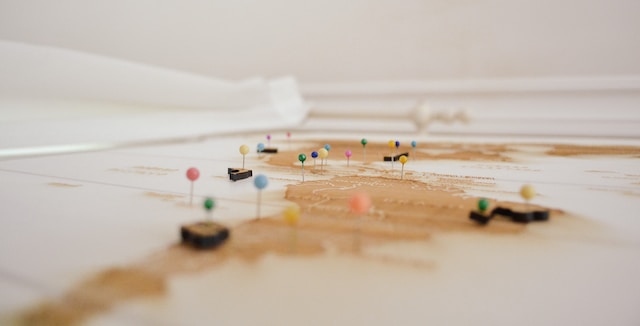
This is a type of map that shows the elevated surface of the Earth. These maps are cool.The idea behind raised relief mapping is to simulate how a physical model looks in real life.
As such, the modeling can range from a full representation with small depths that depict homes, trees, and roads. Then it can go full with larger structures that show off mountain ranges or height differences between two regions.
You may also be someone who can teach others about topography as you read more about the uses and benefits of these maps. Read until the end and you will get a breakdown of how to create one for yourself.
The Difference with Traditional Maps
Raised relief maps are usually carved out of wood, clay, polystyrene foam, or cardboard. It is far different from the typical flat print on paper. It is a form of sculpture art called “relief.”
Instead of printing images on a one-dimensional surface, the relief protrudes images, designs, and patterns from a surface. And thus creating a two- dimensional map.
The maps feature elevated surfaces like ridges, valleys, or terrain. They replicate the natural features of a landscape.
This type of map can depict a detailed landscape of a terrain. It provides layers and contour lines to illustrate altitude changes.
With relief maps, it can be much easier to get a better 3D picture of a region than with traditional flat-paper maps.
Thanks to the fact that they are modeled on real-world conditions, you get a more accurate sight and visual rendering of a field.
The clearer picture and accuracy it provides are why this map is getting more popular nowadays. Its uses and benefits go beyond a usual adventure purpose.
Furthermore, cities and other points of interest can stand out from the rest of the landmass since distinct markers will often represent these essential places.
Triumphs of Topography: Uses of Raised Relief Maps
By creating a raised relief map, you can gain a deeper understanding of the terrain and help plan activities such as hiking, camping, or military strategy.
Raised relief maps are used in both civil engineering and military applications and can provide important information about a location’s topography, including the location and direction of drainage.
Raised relief maps also serve various other purposes, like:
Archaeology
Elevated 3D models can assist researchers in mapping and examining historic locations.
By utilizing topographical representations, archaeologists can use them to decide where to direct their excavations. For instance, an elevated model of a Mayan city could demonstrate numerous large piles concentrated in the dominant area.
This could point out that those piles contained meaningful temples and mansions, thus propelling archaeologists to focus on those sites.
Geology
Geologists use these raised relief maps like a superpower! With the aid of this map, they can ID rock formations. That is why they can tell what type of rocks they belong to.
They can tell if it belongs to a hill, valley, or mountain range due to how the surface of the Earth tells its age. They let them dive deep into the Earth’s guts and see how things work.
And it’s not just about rocks. These maps can help hunt down natural resources like oil, gas, and minerals, like finding treasure.
But more importantly, geologists also use these maps to plan infrastructure projects, like roads, bridges, and pipelines, so that we can minimize the impact on the environment.
Urban development
Topographical models can assist city administrators in planning and constructing metropolitan areas.
Here are some approaches that city development specialists employ in elevated topographic maps:
- Utilizing raised topography charts
- Utilizing contour models to control expansions
- Informing citizens
3D maps can make individuals aware of a development proposal by being put on a show in open areas such as libraries and community centers, enabling the public to offer input.
Education
Utilizing topographical models can aid in teaching pupils about geography and land surface features.
The map is useful in many ways, from devising a journey to examining the planet’s terrain. If you would like to make a raised topographical map, a variety of sources can be found on the internet and in libraries.
The key benefit of Raised Relief Maps
One key benefit of 3D maps is that they help you visualize the terrain in a way that flat maps cannot. According to the US Geological Survey, raised relief maps effectively visualize landforms and other natural features.
It is particularly useful for hiking, camping, and other excursions where you need to know the layout of the land for safety. They can be a really effective tool when planning a trip.
In a 2017 study, it was found that (3D) raised relief maps are more effective than traditional two-dimensional (2D) topographic maps for conveying spatial information.
Despite all its advantages, 3D-raised relief maps can also have their limitations. For instance, in many cases, the intricate details present in these maps may not be necessary for many users who simply need an idea of spatial location or orientation.
That is why it is advisable to get an expert provider of these maps so they can make one that fits your needs. With their assistance, you can avoid reading details or marks that are not of help to you.
The Process of Creating Raised Relief Maps
Creating raised relief maps differs in many ways from traditional methods. It offers great benefits over the traditional method by allowing users to create 3D maps at a fraction of the cost and time.
To illustrate how this can be done quickly and efficiently, it is worth understanding the fundamental techniques used in producing such maps.
Here are the different techniques used for creating relief maps.
- contour drawing
- line drawing
- polygonal drawing
- image mapping
- modeling technology
These techniques allow the user to craft stunning 3D visuals without needing specialist 3D printing or CAD software knowledge. With experts who can use these skills, they offer a level of accuracy while also bringing in some aesthetic appeal.
Now, let’s move on to the next stage – gathering data and creating layers for your map.
Gather Data and Create Layers
Experts must obtain specific information regarding the desired area’s terrain and atmospheric conditions to generate a 3D relief map.
This data is then implemented as the foundation upon which multiple levels combine to provide a three-dimensional image.
Create the Image and Create Texture
The succeeding procedure in constructing a 3D terrain map is to integrate texture and images.
This can be accomplished using image editing programs or texturing applications. The objective is to develop a genuine and aesthetically pleasing depiction while also precisely modeling the landscape.
Have fun Mapping!
The strong points of raised relief maps include adding a level of detail for visualizing landscapes or other geographical locations. It allows greater information to be gained from a single glance at the map.
Before you go, take these three points to remember as you find a relief map or an expert who can make it for you.
- Raised relief maps are more detailed and interactive than traditional two-dimensional maps.
- Flat maps are ideal for educational settings, but they are more portable.
- They can be created using a variety of materials and techniques.
Overall, raised relief mapping provides users with superior details compared to regular flat maps without compromising portability.


